
Walking on Water: A New Linear Park
Ian Napier
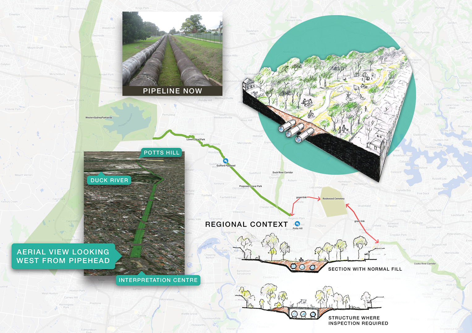
Dual use of Guilford pipeline land for local recreation and regional links
The water pipeline corridor from the Guilford Pipehead to Potts Hill is already partially utilised for a cycle and walking track extending the Prospect Lower Canal facility as far as Military Road, Guilford. The opportunity is there to connect to the Duck River corridor and even on through Rookwood cemetery to the Cooks River.
However, imagine how its FULL potential can be realised.
The current fenced-in ribbon of concrete is a limited functional walking and cycle link beside a vital, but visually unattractive, public utility. With public open space much in demand, especially as middle ring suburbs densify, land used for utilities must ‘work harder’. By covering the pipes with a mixture of hard and soft landscaping and removing the fences, over 25 hectares of open space can be returned to the public, knitting together rather than severing communities.
The integrity and safety of the pipelines is of course paramount: burying the pipes, with appropriate physical/chemical protection and sophisticated electronic monitoring, can ensure the continuing security of our water supply.
The nature of the landscaping will respond to the adjacent land uses and local need, with active play areas adjacent residential development and more natural parkland augmenting parcels of neighbouring bush.
The concept is regional yet can be achieved incrementally block by block. The fill can be sourced from road or rail tunneling projects as available.
Starting with an Interpretive Centre at the Pipehead, the linear park can be themed as a Sydney Water Heritage Walk.