Sydney, river city
Belqis Youssofzay`, David Hart
Rezone, relink and rehabilitate Sydney’s river corridors.
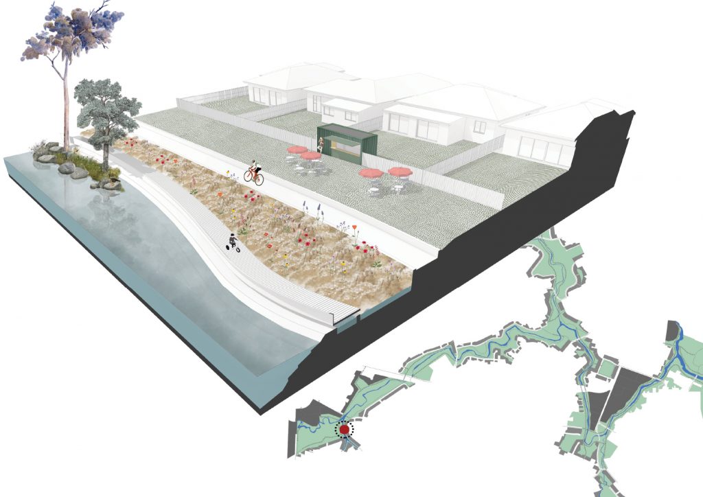
For decades development turned its back to Sydney’s river corridors, filling these spaces with stormwater infrastructure while disregarding any potential for public placemaking. The proposal chooses Toongabbie Creek, linking the heritage areas Parramatta Park, Cumberland Hospital and Third Settlement Reserve, to demonstrate how river corridors can be connected, activated and returned to the public.
- Rezone the perimeter: Residential properties that abut river corridors are rezoned “B4 Mixed Use” to facilitate small business, such as market gardens, retail & cafes. Adjoining industrial sites may be rezoned “R4 High-Density Residential”.
- Connect pathways: Disjointed parks, paths and cycleways are progressively linked together following existing waterways.
- Demolish the back fence: Rear set-back controls are waived for B4 zoned properties wishing to activate their rear frontage with a kiosk or retail space. Limited areas of the public domain may be leased for temporary use, such as café seating or garden beds.
- Rehabilitate the landscape over time: Stormwater infrastructure is redesigned to include controlled wetland weirs in lieu of concrete culverts facilitating a park-like environment. Restorative landscape design encourages the return of lost wetland ecologies, providing habitat for a variety of native flora and fauna.
Answers:
- By improving access to a shared city-wide green space.
- Activating existing landscape through rezoning and leasehold opportunities, establishing long unbroken pedestrian and cycling zones through suburbia.
- The proposal identifies latent continuous sections of Sydney’s suburban landscape occupied by stormwater and services, transforming these areas into greenery and vibrant public space.